2011 Conference -- New Mexico |
The CAASW 2011 conference was held at the University of New Mexico in Albuquerque, NM on June 16 - June 18, 2011 at the Hibben Center for Archaeological Research, the site of the historic 1983 conference “Astronomy and Ceremony in the Prehistoric Southwest” [Papers of the Maxwell Museum of Anthropology #2]. CAASW 2011 was both a retrospective, referencing the 1983 Maxwell Conference, and had a contemporary look at recent work in Cultural Astronomy.
|
Methods, Architecture, and Intervisibility
|
|
 |
North, South, East, West: Cultural Intent, Precision and Interpretative Studies The cardinal directions, North, South, East, and West, are nearly universally recognized by indigenous peoples. Clearly sacred attributes have been given to these directions. However, the culturally recognized or desired absolute azimuth accuracy for the cardinal directions may be less universal. In some cases, like Pueblo Bonito with its North-South symmetry and southern East-West perimeter, or Casa Rinconada with its North-South symmetry, striking cardinality is found. We see intervisibility of buildings, like the North-South centerline of Casa Rinconada being reasonably aligned toward Pueblo Alto. In other cases, like the positions of the Navajo sacred mountains, the directions are loosely defined. We will examine the accuracy expectations we may have for indigenous Southwest cultures in definition of the cardinal directions. The assumed accuracy available can be employed in the research design, in turn allowing use of Monte Carlo methods to evaluate the propensity of false positives in observed cardinal alignment. |
 |
Traditional Ritual Site Location and Geographical Considerations in Kohala, Hawaii Island Polynesian colonists who discovered and settled the Hawaiian Islands were expert navigators and relied upon observations of stellar phenomena to cross sizeable ocean distances. The positioning and location of traditional ritual sites, known as heiau, in Hawaii also relied upon celestial features. This has been previously documented with respect to heiau orientation, and some heiau were said to be used for navigational purposes. Archaeological research in the Kohala district of Hawaii Island has documented several different aspects of heiau location, landscape positioning, and inter-visibility that reflect celestial considerations. Examples are presented to illustrate each of these and to link them to traditional Hawaiian knowledge. |
|
Ethics in Mining Tewa Language for Archaeoastronomy Public-access bilingual Tewa-English ethnobotany, ethnogeography, ethnozoology, children’s story books, dictionary, and Christian hymns range from 1905-2000. Digitized formats facilitate searches and compilations for archaeoastronomy knowledge. However, such queries by non-tribal members must be examined for ethics. Contemporary (1989-2001) linguistic fieldwork protocol requires informed consent from native speakers. Contemporary examples of Tewa people not wanting to disclose linguistic complexities to the public are work funded by the Esther Martinez native language preservation act (2003) and University of Washington (1977-2010). |
|
|
Manifestations of Reflected Sunlight in the Southwest and Mesoamerica I “discovered” a prehistoric, in situ rock that I judged to be used to signal, (the prehistoric precursor to mirror signaling) while temporarily erecting a light art installation in Big Bend National Park, located on the Rio Grande, in Texas. According to Bob Mallouf, the director of the Center for Big Bend Studies (at that time) and an archaeologist, the signal rock was “manmade,” the archaeological site a large one, with a long occupation period. This find brought me back full circle to my undergraduate degree in Mayan Archaeology and began my interest in uses of light in the Southwest and Mesoamerica. Currently I am a part time academic and light artist, interested in light in all of its manifestations. Historically, W.D. Smithers, a Spanish speaking, lifetime resident, author and photographer of the Big Bend area, wrote about “avisadores and curanderos” in Chronicles of the Big Bend. Curnaderos are/were the indigenous healers that utilized local plants for curing purposes. Avisadores were usually curanderos who carried mirrors in their pockets to signal (i.e. to communicate with). Smithers states that the mirror communications were detailed, covered many miles and was nicknamed the “Mexican Grapevine.” The University of Texas Austin, in the Ransom Center, houses Smithers’s photographs (10,000 of them). The photos are images of curanderos, curanderos that are signaling with mirrors, native peoples in the US and Mexico, their homes, animals, the plants that they used to heal with and other day-to-day occurrences. Smithers also mentions that Cortez could never surprise the natives who signaled ahead of his arrivals. My current research indicates that “line of sight” signaling was used in many prehistoric sites from Chaco Canyon, New Mexico, to Paquime or Casas Grandes, Chihuahua. The Aztec, Maya and Olmec possessed mirrors made of pyrite, obsidian and mica that were used for self-reflection, scrying, adornment in shields, pectorals and headdresses. They worshipped Tezcatlipoca, who wears mirrors and has an obsidian mirror foot to replace the one bitten off by the earth monster. Mirrors represent an entrance to the underworld marked on ball courts and architecture. Karl Taube identifies many of the same uses and meanings of mirrors from the murals at Teotihuacan, (in Art, Ideology and the City of Teotihuacan), that Smithers did. |
|
|
Arizona/Southwest
|
|
 |
An Archaeological and Geological Study of Three Gnomons at the V Bar V Archaeoastronomy Site in Northern Arizona For several years, Ken Zoll has been studying the archaeoastronomy site at the V Bar V Heritage Site located on the Coconino National Forest in Northern Arizona. At this Sinagua site, two shadow casting rocks, or gnomons, interact throughout the year with a series of petroglyphs pecked into a sandstone cliff, creating a light and shadow calendar that has similarities with Pueblo calendars. In addition, a third rock protruding from the cliff creates a shadow pattern that is remarkably similar to the outline of the San Francisco Mountains, a mountain scared to Pueblo and other Native American groups. However, because the three gnomons are located high up on the cliff, close inspection of them has not been possible until recently, when a free-standing scaffold was set up to accommodate detailed examination of the shadow casting rocks. This paper reports on the results of an archaeological and geological study of the three gnomons, which revealed flaking to the gnomons to enhance their shadow casting properties, as well as the placement of a number of small stone wedges around the protruding gnomons to ensure they stayed firmly in place. Our study has demonstrated the importance of close examination of shadow-casting rocks to record their archaeological and geological characteristics, which can provide positive or negative evidence for their intentional use as gnomons. Determining that humans modified naturally occurring shadow-casting rock features that interact with petroglyphs can help support arguments that light and shadow interactions with petroglyphs were intentionally designed rather than being merely coincidental. |
 |
Astronomy, Water Sources, and Religion In 1996 while locating groundwater sources for Nasca, Peru I realized the ancient inhabitants mapped aquifers that flowed independent of the Rio Grande de Nasca drainage tributaries with geoglyphs, also known as the Nasca Lines. Interestingly habitation, cemetery and ceremonial sites were located where these aquifers intersected the river valleys. While many of the geoglyphs mapped the flow of the aquifers, other shapes documented astronomical events such as the solstices and equinoxes. Another feature associated with these locations is ritual sites. In each case, astronomical observatories and ritual sites were located over aquifers. Eventually I expanded my research along more than a thousand miles of Peru and Chile’s coastal desert and found the same correlation existed. Additional surveys in the southwestern United States have shown a very similar relationship exists. When one considers the harsh nature of these parched environments it is only natural for the ancient residents to study, locate and document aquifers and seasonal changes. In their quest to locate water and determine seasonal changes rituals played an integral role. This paper will discuss a variety of sites in both Peru and the southwestern United States where these features are found in conjunction with one another. |
 |
Sears Point: Opportunity for Archaeoastronomy Research In an Arizona recording project for the BLM, a massive database of 28,000 images has been taken of rock art at Sears Point. Fifteen contemporary tribes claim cultural affiliation with this site. Field observations associated with photographic recording include notation of horizon response where relevant, and particular features of Rock Art that we find remarkable. Tom Hoskinson, John Fountain and others have made archaeoastronomical claims in this area. While it is not our purpose to record archaeoastronomical alignments, we express the methods we use for this comprehensive survey. For a small number of rock art panels (~5), we feel that special features may be suggestive for further observations. We recommend specialists consider these sites for further research in cultural astronomy. |
|
Mesoamerican - Southwest Connection
|
|
 |
Stars and Sacrifice in Greater Mesoamerica and Beyond Venus or “Great Star” as a male deity of warfare and sacrifice was well established in the Mesoamerican tradition at least by the Late Formative period – approximately two millennia ago – and perhaps as far back as the Middle Formative (ca. 800 BCE). Venus Almanacs, based on the resonances between the pervasive 260-day “Sacred Almanac,” and canonical periods for the solar year (365 days) and synodic period of Venus (584 days), were used to regulate these practices, which included “astrology” and calendrical divination. Five are found in the approximately 16 surviving pre-Columbian codices. Over time across Greater Mesoamerica, various conventions for the representation of the sky and its denizens including stars, the Sun, Moon, and planets (Venus in particular) evolved. The author has cataloged a wealth of examples from all media and classified these Star and Great Star representations – with their Full, Half, embodied, and personified variations – into five families, with variations, for comparison and study. This presentation will briefly introduce this classification system and then concentrate on specific examples of stars in the context of human sacrifice, some in the form of actual sacrificial instruments. |
 |
The Morningstar/Rain/Maize complex in the American Southwest This paper reviews Morningstar iconography in the art and religion of the Pueblo Southwest as a peripheral manifestation of an ancient and widespread complex in Mesoamerica. In Mesoamerica, the timed disappearances and reappearances of Venus became a metaphor for life cycles of both maize and humans. As a bellicose planet, Venus was widely associated with both war and death as well as with the complementary notion of renewal. Its associations with a war/fertility complex among maize agriculturalists throughout Meso and North America was/is pervasive. In late pre-contact Pueblo rock art and kiva murals Morningstar imagery is closely linked to both warfare iconography and associations with the Horned Serpent point directly to Quetzalcoatl and his avatars in Mexico. In addition, the Knifewing/Morningstar configuration in Pueblo iconography is identified with scalps acquired in conflict that, in turn, functioned as rain fetishes. While having explored these associations in earlier publications, this paper seeks to expand on the symbolism incorporated in this conceptual packet, thus furthering our understanding of the complexity of a single celestial entity and how this drama was played out in the distant Southwest. |
 |
As the Macaw Flies: Mesoamerican-Southwestern Interaction in Astronomy, Cosmology, and Materials The recent discovery of cacao remnants in Chacoan cylindrical jars is just one more example of evidence for Mesoamerican-Southwestern interaction along with macaws, parrots, copper bells, pseudo-cloisonné invested materials, pyramid mounds and other architectural features, pyrite mirrors (?), astronomy and cosmology, and much more. Indeed, George H. Pepper suggested a connection between the Chakchiquel Maya and the Chacoans of Pueblo Bonito in terms of the shapes of the cylindrical vessels in his 1920 Pueblo Bonito report. The evidence for cacao drinking at Chaco Canyon is new; the idea of a connection between the cultures that manufactured the vessels is not. This presentation is a necessarily brief overview of Mesoamerican-Southwestern interaction with a focus on astronomy and cosmology: astronomical phenomena observed and recorded in both areas, the uses to which such data were put in daily life, and some of the underlying cosmology which shaped these activities and which, in turn, was refined by the observations and resultant thought. The author founded The Feather Distribution Project in 1982 in response to a Cochiti man’s request for macaw feathers. Since then, we have distributed more than nine million macaw, smaller parrot, and wild turkeys to all 31 Pueblo villages free-of-charge. During the course of this project, which is ongoing, a great deal has been learned about Mesoamerican-Southwester interaction across a wide range of issues and activities, notably the importance of macaws, which were not and are not indigenous in the Southwest but were all imports, in one form or another, from Mesoamerica. Their role in Puebloan cosmology is also briefly discussed. |
|
Chaco - Mesoamerica
|
|
 |
Mesoamerican Pochteca and "The Chaco Phenomenon" Astronomical and cosmological counterparts of Mesoamerican ideology are unquestionably evident in Chaco. Past suggestions and recently researched evidences of pochtecan presence at Pueblo Bonito clearly demonstrate that both highly specific material and behavioral correlates are extant. The key motivating factor for long-distance traders to establish a northern outpost in Chaco Canyon relates to a shift from jade to turquoise as the elite "God Stone" and a previous awareness of the abundance of high quality turquoise within the American Southwest. This change at ca. 900 AD coincides with the onset of the Early Post-Classic (Toltec Horizon). Highly germane to this paper is the current widely accepted notion of "Greater Mesoamerica" wherein contact, trade, ideology, and more, were commonplace from Pre-Classic times throughout the Mesoamerican cultural sequence. Toltecan researchers note the undoubted presence of pochteca at Tula and the acquisition of exotic elite goods extending from the American Southwest (turquoise) in the north to Panama (gold) in the south. The question of whether the militaristic Toltec or a more northerly Mesoamerican pochteca group established themselves at Chaco will be addressed. |
 |
Heaven on Earth: The Chaco North Road Chaco and post-Chaco "roads" are essentially large and sometimes elaborately engineered trails that accommodated, facilitated, and controlled certain pedestrian traffic during the Pueblo II-III periods (ca. AD 900 -1300) across the Colorado Plateau. Beginning at Pueblo Bonito in Chaco Canyon and extending over 50 miles in length, the North Road (ca. AD 1050 -1150) is one of the few truly regional features of its kind in the San Juan Basin of northwest New Mexico. Previous archaeological research has speculated on the religious role that the roads may have played in the pre-Columbian past, including the North Road as a symbolic representation of Chacoan cosmology and that Chaco roads connect a ritual landscape in part defined by religious architecture. Recent research considers that at least part of the North Road orientation was to mirror on earth what was present in the night sky at a time of known seasonal importance. |
 |
“A Brilliant Star Arose in the Southeast” Migration, Stellar Navigation, and Chacoan Architecture Among the Bonito Phase Great Houses within and near to Chaco Canyon N.M., three architectural traditions with astronomical associations are evident. The front facing South-Southeast (SSE) orientation was predominant prior to A.D. 1000. Between A.D. 1000 and 1060, the construction of increasingly accurate architectural alignments to the cardinal directions of North/South and East/West (NS/EW) began at Hungo Pavi and Pueblo Alto. During the same period, SSE-facing Chetro Ketl completed the first inter-site cardinal alignment at Chaco; it is positioned due east of Pueblo Bonito. Sometime after A.D. 1075, Pueblo Bonito’s gradual reorientation from SSE to precise N/S and E/W alignment was completed. Two of the Late Bonito Great Houses that were newly-constructed A.D. 1100-1140 (Tsin Kletsin and New Alto) complete N/S inter-site alignments. All of the other Late Bonito Great Houses at Chaco are positioned at or near to workable solstice horizon calendars. Some Great Houses manifest two of these traditions, but the “halo” Great House of Bis sa ani is the sole example found to date that incorporates all three. Bis sa ani includes both cardinal N/S E/W and SSE room blocks, and is also well positioned to act as a calendrical station for a June solstice sunrise horizon marker. The astronomical associations of the cardinal directions and solstice horizon calendars are explicit, and cultural pertinence for both is well documented in the ethnographic record. The SSE orientation has been more enigmatic. We expand upon our previous proposal that the front-facing SSE orientation is most plausibly linked to migration traditions and ancestor veneration. We provide an overview of alternative hypotheses considered for this orientation. We discuss the ethnographic evidence supporting the migration proposal in greater detail, and present a model for use of a staff as a sighting device to accomplish stellar navigation to the southeast. The presented model is consistent with the Hopi Snake Clan migration myth documented by Mindeleff, and also provides a plausible method to account for centuries of ancestral Pueblo orientation of architecture to the SSE. |
 |
The Enigma of Fajada Butte One of most remarkable features of Fajada Butte is the massive ramp that was built on its southwestern side. At the top of the ramp is a fire reddened slab box one meter on a side. Another firebox was present at the base of the ramp. A road leads from the base of the ramp toward the great kiva in Marcia’s Rincon, and fires in those boxes would have been visible in that great kiva, but probably not at other great kivas or great houses in the canyon. Its meaning could be similar to that of stairways in the canyon that may have been more symbolic than practical and expressive of shamanic themes of ascent and descent. Judging from its masonry style and associated ceramics, the ramp appears to have been contemporaneous with the Classic Bonito Phase and may have been associated with the carrying of fire to the firebox at its top, perhaps similar to a ceremony performed at the fire pit at Chimney Rock prior to the arrival of Chacoan influence and, much later, the Zuni New Fire Ceremony. The upper terrace of Fajada Butte contains the sites 29SJ 296 and 29SJ297 with a total of 30-35 rooms including one circular kiva. The presence of manos, utility ware, burned corn cobs, and hearths indicate these remote rooms were used as residences. Their roofs provided access to a number of petroglyphs, which probably do not predate construction. There are spirals, intertwined spirals, a snake, and two rectangular figures over which shadows pass at the solstices and equinoxes, although apparently none of the interactions of light and shadow uniquely marks those days. The majority of the ceramics from the rooms comes from the A.D. 1200s, such as Mesa Verde Black on white. The wall construction of the room does not contain decorative elements in the form of chinking stones or core and veneer construction as found in the Great Houses in the Canyon. The walls of the rooms resemble those of Gallo Cliff Dwelling in which maize cobs have been dated to AD 1190. Since the construction style and the predominant ceramics suggest that these rooms were primarily the product of the post-Chaco re-population of the canyon, the various petroglyphs may therefore be dated to the later period. The sandstone slabs that produce the “sun dagger” are 2-3 meters high, and each weighs approximately 2 metric tons. The consensus of geologists who have inspected the area is that the slabs are the results of a natural rock fall, part of a single block that broke off the cliff, toppled over, and split along bedding planes. Similar sets of three or more upright slabs are found elsewhere in the canyon. The spirals behind the slabs are probably associated with the occupation of the upper ledges of the butte as a refuge during the 12th and 13th centuries. The majority of the ceramics are Mesa Verde B/w, which account for 56% of all white ware. Gallup B/w, the "ceramic hallmark" for the Classic Bonito Phase, accounted for only 5.6%. When the area was repopulated in the 1200s the ramp was apparently again used, this time to access the rooms on the upper ledge. These rooms may have been refuges for women and children during threatening times. The last half of the 13th century appears to have been unsettled and dangerous times. Kohler has provided evidence for kidnapping of woman at that time. Sometime around A.D. 1280, some 41 men, women, and children were violently killed at Castle Rock Pueblo, their remains left unburied among the ruins of the village. The Castle Rock Pueblo had been built with defense in mind, and healed bones of some of the skeletons revealed that this final attack on the pueblo had not been the first. It is not unusual for uncertainty and danger to provoke an increasing interest in the powers that reside in the heavens and appearance of shamanism with its hallmark symbolism of spirals and circles. Stein and Fowler describe the rooms of Fajada as typical "pinnacle" structures, briefly occupied for reasons of safety. The rooms appear to be members of the class of defensive settlements and refuges of late Pueblo III, such as those on remote spires in Kayenta as described by Haas and Creamer, and semi-defensive settlements of Castle Rock, Sand Canyon, and Goodman Point. The spiral behind the three slabs clearly marks June solstice, which is the only date that is indisputably marked at the three-slab site. The date of solstice could have been provided by the primary calendrical station at Piedra del Sol, which is visible from the three slabs. The diagonal pecked line crossing the larger spiral may parallel the shadow-line formed by the sun around May 14-15, marking a planting festival. It is highly unlikely that the line was intended to mark minor lunar standstill. |
|
Navajo Ethnoastronomy
|
|
 |
Mesoamerican Cosmology in the Dinétah The presentation examines two ceremonial sites in northwest New Mexico. The sites appear to offer visual experiences of aspects seen in Mesoamerican cosmology myths. Site one reflects the Mesoamerican theme of the “dawn of Life” noted in a calendar referred to as the long count, and equivalent to the Gregorian date of August 11, 3114 BCE. The site has Basketmaker petroglyph anthropomorphs, but a figure at the bottom of the group is the focus of attention. It appears that the anthropomorph is constructed to reflect the three hearthstones of creation. These three hearthstones are marked out by the stars Alnitak, Rigel and Saiph in the constellation of Orion. The triangle encloses the M-42 nebula which is a symbol for the first fire of creation. These astronomical notations reflect an ethnohistorical event of creation where the first fire is drilled at the hearth. At sunrise on August 11, the sun causes an arrow-like projection to point at the center of the anthropomorph where the first fire was created. Site two is a sandstone boulder located on a talus slope. It is about 80 cm in height and 120 cm in length, and has a tunnel bored through it three cm in diameter and one meter in length. On the winter solstice, at approximately 2:15 p.m., the sun shines through the bore. Due to weather problems, the documentation is poor, but it appears that the sun shines through the bore when it is at an azimuth of 211° and an altitude of 22°. The location of the sun at this time is significant for the position of the galactic equator is vertical to the horizon. This observation can be made on a desktop planetarium by turning off the daylight. It would appear that those who created this site are attempting to document a key symbol of Mesoamerican cosmology – the World Tree. |
 |
So' Diné: A Review of Navajo Astronomy in Dinétah In Dinétah, the genesis homeland of the Navajo in northwest New Mexico, examples of culture change and continuity abound in the archaeological record between the 15th - 18th centuries. Navajo astronomical symbolism is one line of archaeological evidence during this dynamic and at times turbulent period of Navajo history. This evidence is present most noticeably, although not exclusively so, in rock art, the probable precursor to the more well known sandpaintings. A review of the range and diversity of Navajo astronomical elements in Dinétah rock art and other forms is presented, and the seasonality of their creation is considered. |
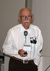 |
The Navajo Landscape and Archaeoastronomy David M. Brugge (University of New Mexico) Navajo country is extensive. Traditionally it is bounded by four sacred mountains while its interior is filled with many places defining a holy landscape that changed through the centuries as population distribution has shifted in response to weather patterns and relations with neighboring peoples. The traditional stories associated with the geography include some features that may relate to astronomical phenomena. The most suggestive of these accounts is that of The Life of Changing Woman, the one fully benign deity in The Navajo pantheon. |
|
Northern San Juan Region
|
|
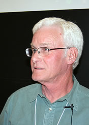 |
Evidence of Moiety Organization at Jackson’s Castle, Southwest Colorado. This paper describes an equinoctial alignment at the Pueblo III site of Jackson’s Castle, in southwest Colorado, and explores what this alignment might have meant to the community that occupied the site. Jackson’s Castle has an observed equinoctial solar alignment between a two-story structure within the site and a prominent hill approximately 250 meters to the east that is capped with a large, upright stone shrine. We interpret the significance of this alignment through the lens of Tewa Pueblo ethnography, following recent studies suggesting that Tewa ancestors lived in southwest Colorado. In his discussion of Tewa dual organization, Alfonso Ortiz suggests that the change in seasonal leadership originally took place around the equinox, and that equinoctial alignments are one of the symbolic bases of the moiety system. The timing of the change in moiety chief, as indicated by the equinoctial alignment, would set in motion changes in the ritual and subsistence activities of the community. Because the sun is moving rapidly with respect to the horizon around the equinox, and the hill on which the shrine occurs is immovable, we conclude that the builders of Jackson’s Castle intentionally placed the village so they could mark the equinox in a public way. This suggests an attempt to link community sociopolitical organization to celestial cycles and the cultural landscape. |
 |
An Ancient Observatory at Salmon Pueblo Implications have been suggested that observations made by prehistoric astronomers were incorporated into the construction of Ancestral Puebloan structures. It has been proposed that architectural floor plans of several buildings in Chaco Canyon, New Mexico and its outliers are the result of astronomical geometry being used. Such relationships have been interpreted for Salmon Pueblo, a Chacoan satellite on the San Juan River. Continuing research on archaeoastronomy at this site has revealed a single room that functioned as an observatory for making celestial observations. Data on the room’s constructional features as related to astronomy are presented to support this conclusion. |
 |
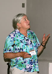
The Solar Program at Aztec Ruin Great Kiva The restored Great Kiva at Aztec Ruin, New Mexico provides a working model for investigating potential and previously unrecognized solar alignments built into ancient Chacoan Great Kiva designs. Similar solar alignments are well documented for other ancestral Puebloan Great Kivas, particularly the well known Casa Rinconada Great Kiva in Chaco Canyon. At Aztec Great Kiva, architectural features such as the asymmetrical, uneven placement of windows and the offset central firepit and associated rooftop opening, are consistent with other Great Kivas, but reflect design principles inconsistent, and somewhat unexplainable, with the general overall symmetry and balance of design in most Great Kiva plans. However, specific observable and documented patterns of solar light and shadow cast through and upon these features on solar equinoxes and solstices, presented herein, suggest that these seemingly “anomalous” design features in fact reflected clear observance of seasonally specific solar events, as well as possibly choreographing related ritual activity. On certain specific days, rays of sunlight penetrate the kiva interior through windows, doorways or the ceiling opening, highlighting and directing attention to specific interior kiva features, such as wall niches or the central firepit. Early historic Puebloan ethnographic sources provide compelling descriptions of ritual activity conducted in kiva settings, associated with similar solar phenomena and specific calendric or seasonal cycles. J. Walter Fewkes, for example, reported Hopi priests initiating and coordinating ritual activity by observing the movement and location of specific solar light patterns cast upon interior kiva floors or walls. The patterns recorded at Aztec and related Great Kivas suggest a continuity of spatial function and symbolism extending back to at least the Chacoan Period in the Southwest, and perhaps provide deeper insight into specific ceremonial activity practiced within the Great Kivas. This presentation considers possible implications of the documented solar events as well as associated interpretive problems. |
 |
Utilization of Ethnographic Sources for Possible Interpretation of Petroglyphic Based Archaeoastronomy Sites in the Northern San Juan Region of Colorado The authors have spent years studying archaeoastronomy sites throughout the Four Corners area and have gained an understanding of how the ancient Basketmakers and Puebloans used light and shadow patterns to pinpoint the solstices. Most of the studied sites incorporated spiral petroglyphs to demonstrate the solstice, but in Mancos Canyon additional auxiliary glyphs and pecked depressions were utilized to meaningfully enhance the accuracy of the solstice display. Five very accurate winter and summer solstice sites have been selected that will demonstrate some basic mechanics utilized to display or mark the solstices. These sites were created more than a thousand years ago. Because of similarities in these five sites, patterns began to emerge that suggested elements of compulsive magic. Some of those elements were confirmed through ethnographic research and dialog with a few Hopi tribal elders. In this high desert environment the growing season is short, rainfall is unreliable and farmers are/were always nervous about their potential harvests. Today’s farmers may carrying a lucky rabbit’s foot or some other lucky object, it will be shown that the ancient farmers employed ritual depictions in their solstice displays in hopes of having a good harvest. |
|
Methods in Archaeoastronomy
|
|
 |
Archaeoastronomy Methodology: Landscape Context and Long Base-line Sighting at the Big Horn Medicine Wheel, WY as an Example of the Need for Extended Site Surveys, Documentation, and Protection The Big Horn Medicine Wheel (BHMW) is a nationally protected historic landmark and sacred site. The Wheel’s astronomical attributes were not a factor in this designation. The astronomical nature of the Wheel has been under criticism for over twenty-five years. Critics believed that the lack of precision of the Wheel’s cairn-to-cairn stellar alignments made it impossible to determine which stars were really aligned with the wheel’s cairns. The research on these stellar alignments, based on broad pile of rocks (the cairns), appeared suspect. Research previously done at the Wheel did not take into consideration long base-line sightings, yet a solution to this critique of precision can be demonstrated by applying the basic archaeoastronomical methodology of long base-line sightings from outlying cairns through the center Wheel complex. John Eddy proposed the first stellar alignments at the Wheel in 1974 and a few years later Jack Robinson modified that seminal work. Fifty years earlier, in 1922, the anthropologist George Bird Grinnell had described, measured distances, and gave general directions to a set of distant, outlying cairns surrounding the BHMW. Grinnell’s outliers may no longer have been present when Eddy and Robinson analyzed the site. These cairns were likely used to build the protective wall around the wheel by early, well-intentioned preservationists who saw significance only in the central wheel. When these outlying cairns are added back in to the context of astronomical possibilities, however, the long repeated critique concerning angular inaccuracy of stellar sightings is met by the increased precision affordable through long baseline sighting. This underscores the importance of surveying and documenting the contextual, extended landscape of a site and shows the usefulness in long base-line sighting as an archaeoastronomical methodology. This talk will discuss the specifics of the Big Horn Medicine Wheel as an example of the importance of the general methodology of long base-line sighting. Documenting the larger landscape beyond the most obvious aspects of a site becomes all-important when considering preservation based on possible astronomical uses. |
 |
Cultural Astronomy in the Field Gathering information about the sky from people living today can be a complicated procedure. Who do you ask? How do you weight what people tell you? As a researcher, one must have a good enough command of the night sky in order to name those objects alluded to by people. In addition, one must have a general understanding of what people tend to know about the night sky and how they use the night sky. This presentation is a crash course on a few useful techniques for collecting sky information and related knowledge from groups of people living today. |
|
Open Session
|
|
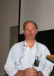 |
The Hooper Ranch Pueblo Sun Dagger Shrine Located above the Little Colorado River in east-central Arizona, a previously unknown natural rock formation allows a pointed shaft of sunlight to illuminate a panel of ancient petroglyphs during the summer months. At the summer solstice, this dagger of light divides a spiral glyph in half, as it links several other images together depicting a story from native folklore about Monster Slayer and his younger brother Child-Born-of-Water. Based on the estimated age and its associated images, this site may have provided the inspiration for the creation of a highly similar sun dagger located upon Fajada Butte in Chaco Canyon. Additionally, on top of an overhanging boulder, a drilled hole forms the head of a symbolic stickman petroglyph. In ancient times, this fabricated hole likely held prayer-sticks offered to the Water Clan god, Panaiyoikyasi, as a sandstone figurine of this deity was found buried nearby in a special kiva crypt aligned with the location of this solar shrine. |